
How Satellite Imagery Is Transforming NJ Property Assessment
Bridges AI
AI Strategy & Engineering
The traditional inspection model, clipboard and camera and a long day of driving, now has a far more scalable companion: satellite and aerial imagery analysis.
What can computer vision detect?
Models trained on aerial imagery can reliably identify:
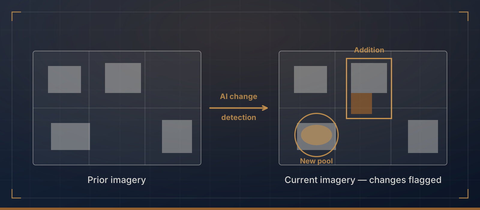
Building footprint changes. New construction, additions, and demolitions are visible from above. Comparing images across dates flags properties where the footprint changed, indicating improvements that may never have triggered a building permit.
Story count estimation. Shadow analysis and 3D modeling from stereo imagery estimate building heights and story counts, verifying that property records match physical reality.
Accessory structures. Pools, detached garages, sheds, and outbuildings are often missing from property records. Aerial analysis catches them systematically.
Roof condition indicators. Not a replacement for physical inspection, but imagery flags roofs showing deterioration, tarping, or recent replacement, all relevant to condition assessment.
Solar panel installations. Rapid adoption of residential solar raises assessment questions in many jurisdictions, and aerial detection captures installations consistently.
Why does this matter in NJ?
New Jersey's 564 municipalities manage assessment records for every parcel in the state, and most assessor offices cannot physically inspect every property on a regular cycle. Imagery analysis focuses field visits on the parcels where a change was detected, covering more ground with fewer resources.
What are the limitations?
- Interior conditions are invisible. Renovations, mechanical systems, and interior quality need a physical inspection or permit records.
- Image resolution varies. Commercial satellite imagery typically offers 30-50cm resolution, which is good enough for buildings and pools, but not fine details.
- Seasonal variation matters. Tree canopy can obscure structures in summer imagery. Winter captures provide clearer views but may miss landscaping features.
- Comparison requires consistent imagery. Change detection works best with captures from the same season across multiple years.
Where should you start?
Change detection: comparing current aerial imagery against your most recent inspection data to find properties that need field review. It replaces nothing in your workflow; it is a screening layer that keeps field time on the properties that need it.
Bridges AI integrates aerial imagery analysis with assessment data for NJ municipalities. Learn how change detection works for your district.
Related posts
2026 NJ Appeal Season: The Assessor's Preparation Checklist
Appeal filing deadlines are approaching. Here's a practical checklist for NJ tax assessors to prepare defensible valuations and minimize revenue loss.
Property AssessmentCOD, PRD, and Uniformity: What Every NJ Assessor Needs to Know
IAAO uniformity metrics are increasingly used to evaluate NJ assessments. Here's what COD and PRD mean for your municipality, and how to improve them.
Property AssessmentWhy Your Director's Ratio Should Worry You (And What AI Can Do About It)
New Jersey municipalities with Director's Ratios below 85% face mounting appeal risk. Here's how AI-powered assessment intelligence helps assessors stay ahead.